Impact of the Gannon Storm on corn: economic assessment of agricultural production and revenue losses due to GNSS signal degradation
Terry
Griffin
Kansas State University
Poster
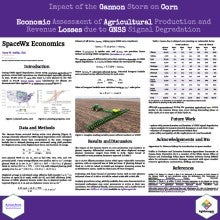
The Gannon Storm of 10-12 May 2024 disrupted the global navigation satellite system (GNSS) signals, affecting precision agriculture that resulted in economic losses. Initial assessments conservatively estimated agricultural production losses for the US at $500M. Since then, the half-billion-dollar estimate has been cited multiple times in presentations and popular media outlets. The foundation for this poster is a comprehensive written report with sensitivity analyses over a range of farm assumptions across several representative scenarios. For transparency, the methodology for quantifying economic losses due to delayed corn planting caused by GNSS signal degradation from the foundational report is presented along with one pertinent scenario. Using publicly available United States Department of Agriculture (USDA) data, the proportion of planted acres dependent on GNSS guidance, farm size distributions, and the market share of vulnerable differential correction systems (DGPS) across 12 Midwestern corn-producing states are assessed. Losses were expected to be between $12,000 and $17,000 per farm, depending on local planting progress and effective field capacity of planting equipment. By evaluating various market shares of vulnerable DGPS systems across different equipment sizes, total revenue losses between $53M and $1.29B due to planting delays were estimated across 12 Midwestern states. These findings provide critical insights for development of space weather alert systems, agricultural policymakers, GNSS specialists, precision farming practitioners, space weather professionals and enthusiasts, and GNSS infrastructure stakeholders, emphasizing the need for enhanced resilience in agriculture-dependent satellite services.
Poster PDF
Meeting homepage