Utilization of GPSRO in the NOAA Products Validation System (NPROVS)
Bomin
Sun
IMSG at NOAA/NESDIS/STAR
Poster
The NOAA Products Validation System (NPROVS) was established at the NOAA Center for Satellite Applications and Research (STAR) in 2008. NPROVS provides an “enterprise” validation approach through the routine compilation and analysis of collocated radiosonde and satellite observations from multiple spacecraft. NPROVS is funded by the NOAA Joint Polar Satellite System (JPSS) calibration/validation (Cal/Val) program in direct support of NOAA operational satellite (S-NPP and recently deployed NOAA-20) derived atmospheric sounding products.
Satellite profiles evaluated in NPROVS include product suites from different satellites (i.e., NOAA, NASA, EUMETSAT and Global Navigational Satellite System (GNSS),instruments (i.e., infrared, microwave, and Radio Occultation (RO) and associated retrieval algorithms. The assessment approach is enterprise, meaning that common samples of radiosonde profiles are used to assess respective profile sets. Radiosonde sets include separation by conventional, Global Climate Observing System (GCOS) Reference Upper Air Network (GRUAN) and special JPSS funded radiosondes targeted at satellite overpass. GNSS-RO products include data from the Constellation Observing System for Meteorology, Ionosphere, and Climate (COSMIC) mission, provided by UCAR COSMIC Data Analysis and Archive Center (CDAAC) and from the MetOp mission, provided by the EUMETSAT Radio Occultation Meteorology (ROM) Satellite Application Facility (SAF).
Several focus areas on the use of GPSRO in NPROVS are summarized in this presentation.
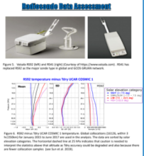
1. The accuracy assessment of Vaisala RS92 versus RS41 upper air observations using GNSS-ROO dry temperature data as the reference. RS41 has been gradually replacing RS92 in the global conventional and GRUAN networks and it is of high interest to the satellite, weather and climate communities to manage the transition from RS92 to RS41. RO is highly valuable to assess radiation induced error in radiosonde.
2. The consistency between GPSRO, satellite microwave, and GRUAN observations in terms of long-term trends and inter-annual variability of upper air temperatures. This has evolved from recent coordination between STAR, Global Space-based Inter-Calibration System (GSICS) and GRUAN to investigate using GPSRO and GRUAN data to monitor satellite microwave and infra-red sensors onboard operational environmental satellites and respective feedbacks.
3. The capability of NPROVS to monitor and assess the planned atmospheric profiles from COSMIC-2.

Poster PDF