Our Hurricane Prediction Team and a New Innovation this Season
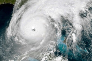
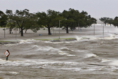
Our team at the National Hurricane Center’s (NHC) Storm Surge Unit has been busy at work this hurricane season which wraps up at the end of November. A hurricane is a powerful tropical storm characterized by strong winds, heavy rainfall, and low atmospheric pressure. These storms form over warm ocean waters, typically in tropical and subtropical regions, and can cause significant damage due to high winds, storm surges, and flooding when they make landfall. The ocean surge and flooding that follow in its wake can do even more harm. Storm surges have been known to go 25 miles inland, submerging cars and flooding houses in its path. Our co-workers at the NHC Storm Surge Unit play a critical role in protecting us.
The NHC monitors, predicts, and provides information about hurricanes with these key functions:
- Forecasting: The NHC uses advanced computer models and meteorological data to predict the path and intensity of hurricanes. They provide forecasts that help communities prepare for potential impacts.
- Warnings and Advisories: The NHC issues watches and warnings for hurricanes. A hurricane watch indicates that conditions are favorable for a hurricane, while a warning means a hurricane is expected in the area. These alerts help residents take necessary precautions.
- Public Education: The NHC engages in outreach and education to inform the public about hurricanes, preparedness tips, and the importance of following official guidance during storm events.
- Data Collection and Research: The NHC collects data on hurricanes and conducts research to improve forecasting models and understanding of these storms. This research helps enhance future predictions and response strategies.
- Collaboration: The NHC collaborates with other agencies, local governments, and organizations to ensure effective communication and response to hurricanes.
By providing timely and accurate information, the National Hurricane Center helps reduce the impact of hurricanes on communities, saving lives and property. So a special thank you to our twelve team members at the NHC for all their hard work during this season. Our co-workers include: Joshua Alland, Associate Scientist IV; Alexandria Andonian, Associate Scientist III - GIS Specialist; Jim Applegate, Web Developer III; Lixion Avila, Casual - Administrative/Clerk III, William Booth, Associate Scientist IV; Allie Brannan, Associate Scientist III; Luis Cortes-Hernandez, Program Specialist II; Ethan Gibney, Associate Scientist IV; Andrew Penny, Associate Scientist IV; Tarah Sharon, Associate Scientist IV; Ben Trabing, Associate Scientist III; and Panagiotis Velissariou, Associate Scientist III.
This hurricane season, the NHC announced the introduction of an experimental version of the “cone of uncertainty” in mid-August. Our own Joshua Alland contributed to this effort. The forecast track of the storm is represented by a "cone" shape on their graphic and serves to show the public of the projected path of a tropical depression, storm or hurricane.
This new version of the cone of uncertainty will depict tropical storm and hurricane watches and warnings not only for coastal areas but also for inland regions across the continental United States. The NHC is testing this new product to improve the depiction of risk areas associated with tropical cyclones. The "experimental" designation means that public feedback is welcomed from users to refine the product before it becomes operational.
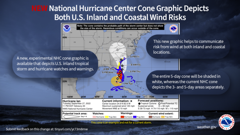
Graphic representing the National Hurricane Center's experimental "cone of uncertainty." Courtesy of NOAA.
This experimental cone will highlight inland watches and warnings, which will take precedence over the cone itself, emphasizing the risk of strong winds. It will unify the visual representation for the entire forecast period by using solid outlines instead of different shading for the first three days and stippling for later forecasts. However, watches and warnings from international areas will only be depicted along the coast due to a lack of communication about inland warnings from other countries. Additionally, there may be instances where forecast points fall outside of issued warnings, particularly when winds extend beyond the storm center. Non-tropical wind warnings will not be represented on the experimental cone, similar to the current operational version.
Continuity in Messaging: The NHC aims to maintain consistent messaging regarding watches and warnings to foster trust and understanding, avoiding frequent changes that could confuse the public. The experimental cone will be included in every advisory, irrespective of whether there are inland warnings in effect.
Learn more about this new cone of uncertainty from the NHC’s blog “Inside the Eye” with their article NHC Cone Heads in a New Direction. A sincere congratulations to our own Josh Alland who contributed to this new innovation!
