Applications of Remote Sensing Techniques for Conserving Freshwater Mussel Habitat During Periods of Drought
The Jones Center at Ichauway
Poster
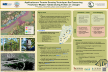
Stresses associated with periodic drought push aquatic species populations towards collapse. A Habitat Conservation Plan (HCP) is under development to guide water management strategies for freshwater mussel habitat throughout the Lower Flint River Basin (LFRB). There are five listed mussel species and one proposed for listing found within the LFRB. Mussels serve as indicators of stream health and are foundational in stream food webs. Unfortunately, some species are highly susceptible to low-flow conditions. We have established nine reaches throughout the LFRB as representative habitats for listed freshwater mussel species. Understanding habitat conditions under varying flows is necessary for developing conservation actions that provide for mussels and aquatic biota, while allowing use of water to support human activities. We are using several remote sensing techniques to develop a digital reconstruction of representative reaches and their adjacent stream valley. These, combined with outputs from various conservation scenarios using hydrologic models, can be used to evaluate potential effects on inundated areas necessary for supporting mussel populations throughout the basin. These methods include the use of an Acoustic Doppler Current Profiler (ADCP) and remote sensing techniques such as terrestrial LiDAR and Unmanned Aerial Vehicles (UAVs). One of our goals is to compare the capabilities and practicality of these modern geospatial approaches for mapping instream habitats. However, each technique presents its unique challenges. For example, while terrestrial LiDAR produces high-resolution three-dimensional point clouds of each reach, it is expensive and cannot penetrate water surfaces. In contrast, we are able to generate low cost, high-resolution orthomosaics using an UAV, but classification is often impeded by tree canopies and water clarity, resulting in very little, if any, usable data. We intend to compare these methods at each of our nine research sites in order to determine the most effective method of predicting effects of conservation scenarios on inundated habitat during periods of drought.
Poster PDF
Meeting homepage