Using Geospatial Technology to Identify High Risk Areas In Precision Farming
Janelle
Shank
Millersville University Student
Poster
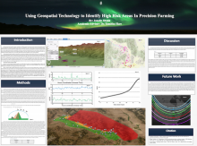
Idaho has the second largest population growth in the United States as of 2023. The current population growth in Idaho is taking farmland at a rapid pace and there are currently no policies to correct it. Because of the reduced availability of land, farmers are searching for land elsewhere and being pushed further to the mountains. Idaho is located at higher magnetic latitude than the majority of states in the USA. At these latitudes GPS is at a higher risk for signal disruption from space weather events during geomagnetic storms. Since there are mountainous areas in Idaho, these regions are already at risk for GPS signal disruptions due to the blockage of signals by the mountains themselves, which increase multi-path signal reception errors. Therefore, farmers scouting for new land to develop need new tools that can both capture and quantify the unique problems associated with GPS-enabled precision farming in both mountainous and high magnetic-latitude terrain. One such tool that will aid farmers is a custom GIS tool. The purpose of this project is to outline the development and application of a new GIS tool designed to enhance how precision farming planning is undertaken. Furthermore, this new approach employs GIS tools to develop methodologies in the creation of a new, space-weather-sensitive metric by determining “risk zones” for the degradation of GPS signal reception, especially in regions where space weather susceptibility is high.
Poster PDF
Poster session day
Poster location
33
Meeting homepage